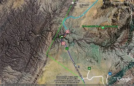
Lots of vehicle accidents in this area, you drive in the desert and can see for miles but suddenly you come upon the Gaub pass with sharp corners and high drop-off to the river below, if your speed is too high and you are caught off guard you fall off the road to the river below.
Roads surface is normally good but the road is narrow here and you will always find oncoming vehicles cutting corners or even worse, people stop in the road to take pictures
Irgenwo hab ich auch gelesen, daß 70 km von Walvis Bay eine sehr unfallträchtige Passage liegt, weil dort ,nach langer gerader Strecke, plötzlich scharfe Kurven auftauchen. Der Fahrer vergisst vor Monotonie die Geschwindigkeit, hat keine Bezugspunkte in der Umgebung und huiiiii.....
 sunnysunshineThemenstarter74 Beiträge · seit 200709. Nov. 2007 ·